FiDi FORGE Public Scoping Meeting
News
Planning updates

The testimony of Michael Kramer, President of Battery to Bridges Coalition, Inc., given to the New York City Economic Development Corporation (NYCEDC) details 8 items Battery to Bridges believes should be included in the Environmental Impact Statement for this project.
Study a “retain and adapt Pier 15” alternative. Pier 15 is a heavily used public waterfront asset that was rebuilt relatively recently. The public has not yet seen a clear explanation of why it must be demolished instead of adapted, elevated, partially floodable, or otherwise incorporated into the resilience design. If demolition is truly necessary, the EIS should explain why. If adaptation is possible, that option should be seriously studied.
Explain the purpose and need for Pier 19 when Pier 15 can be retained, who would use it, who would own or operate it, who would maintain it, and how it relates to the Historic South Street Seaport. If it is tied to deliveries, maritime operations, recreation, historic vessels, emergency access, or flood protection, those functions should be stated plainly. Back of the napkin says that at least $100M can be saved without this new pier.
Examine whether the proposed Piers 7 through 13 ferry terminals can then serve Blue
Highway maritime freight delivery functions. If new ferry infrastructure is already being planned nearby, the EIS should analyze whether that investment can reduce the need for additional in-water construction elsewhere. The community should not be asked to accept both demolition and new pier construction without a clear explanation of why existing or already-planned infrastructure cannot be used more efficiently.

Define the promised Seaport Recreation Center or comparable public-use facility. We support a resilient public facility near the former New Market Building footprint that could serve recreation, youth programming, maritime education, community use, and possibly athletic training. But a public benefit must be more than a concept. The EIS should identify the likely site, size, uses, funding path, public/private decision-making process, and timetable in our likely preferred Alternative Four (Medium Extension).
Study the Brooklyn Bridge shoreline as a public open-space opportunity. The area under the Brooklyn Bridge on the Manhattan side should not be treated as leftover space. The EIS should study whether a resilient beach, cove, ecological edge, or Gansevoort Peninsula-style public access amenity can be created safely, while also helping close the gap tooth between FiDi-Seaport and Brooklyn Bridge-Montgomery coastal resilience.
The approach for pedestrians and human powered transportation should be seamless between the end of the BMCR and the Seaport in the vicinity of the Brooklyn Bridge. We vigorously oppose construction of any wall that separates our communities.

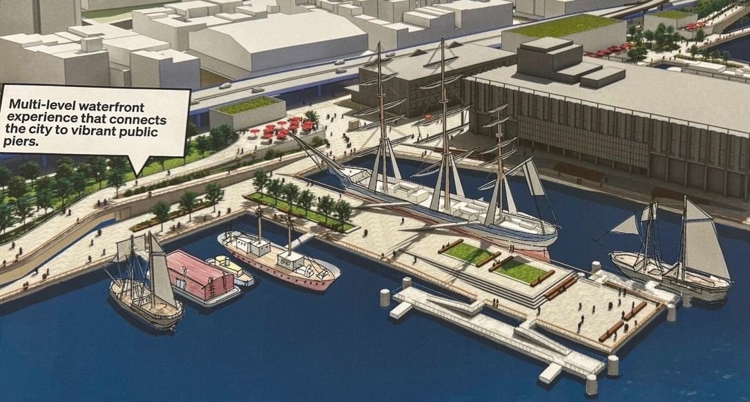
"The purpose of this scoping process is to ask important questions early, before assumptions become locked in. We ask that the Environmental Impact Statement study reasonable alternatives, protect existing public assets, expand real public benefits, and give the community enough information to understand what is being proposed."
Prepare a real maritime-use plan. This waterfront should not become only a flood wall with decoration on top. It should remain a working, civic, historic, educational, recreational, and maritime waterfront. The EIS should identify where historic, educational and emergency vessels, youth maritime programs, small craft, ecological monitoring, and other water-dependent uses can be preserved or expanded.
Provide clearer drawings, phasing, and construction information. The public needs understandable materials showing proposed platform edges, fill areas, pier removals, new pier construction, water depths, habitat impacts, public access points, maritime access, flood gates, construction phasing, temporary closures, and long-term maintenance responsibilities. A project of this scale cannot be meaningfully reviewed by the public or their elected officials through broad renderings and general assurances.
Around the warterfront